|
| Our route from Fremantle to Tasmania. The longest leg was from Albany to Hobart |
The most common route for cruisers is to harbor hop along
the south coast: Fremantle to Albany, Esperance, Cape Arid (Middle Island),
Streaky Bay, Port Lincoln, Adelaide, Kangaroo Island, Portland, Melbourne, across
Bass Straits to King Island then down either the west coast of Tasmania, or through
the notoriously challenging Bass Strait to the east coast of Tasmania. The pro of this course is that you have fewer
overnight passages, plus you get to see some beautiful places few people ever
get to explore. The con is that it can
take many months or more to accomplish the journey as you are sailing against
the prevailing easterly winds. Therefore,
you must wait in each anchorage, or harbor, for the appropriate ‘weather window’
to sail to the next anchorage. Waiting can take
weeks at any given location. We chose the alternate and more direct route and headed
south from Fremantle past Cape Leeuwin to the ‘Roaring Forties’. That is where the westerly winds are
encountered on the southern side of the high pressure systems that march across
southern Australia and the Great Australian Bight. In theory, once the westerly
winds are encountered the course is simple, just head for the southern cape of
Tasmania with the wind behind you.
Of course we knew it was not going to be that simple. Between the high pressure systems that provide
the westerly winds, there are low pressure ridges (fronts) and sometimes major
lows can form and produce major storms. These weather systems would pass over us
moving up to 45 knots compared to our 7 or so knots sailing. Weather predictions are good for about 3 or 4
days, after that, things are much more uncertain.
We are so happy that we invested in an IridumGo unit and a
membership with PredictWind. Even at sea
we were able to get detailed weather predictions from the NOAA GFS (USA) and
ECMWF (European Center for Medium Weather Forecast) model data and
PredictWind’s suggestions for the actual routes we should sail to optimize the
winds and minimize chances of getting hammered by storms. We’ll write another blog about that bit of
technology very soon.
We also chose to have a third person on board to help with
the sailing. We were very fortunate to
have long time friend Peter Coleman. He
is a professional yacht rigger, experienced sailor and knows Katmai well.
In addition, we must give a huge shout-out to David McDonald
in Perth who acted as our shore-based contact and coordinator in event of
emergency. He too was monitoring weather forecasts and routing options and in
daily contact with us via email and text messages over the IridiumGo for status
updates and to provide us feedback. It
was a great comfort to know someone was keeping such a close eye on us. The reality though was if things went pear
shaped for us in the middle of the voyage, we would not have many options for
help. Perhaps a cargo ship could have been
diverted toward us, we definitely ‘hung it out there’ to take this trip. As a delivery captain said to us when he
learned of our plan…"why would you go south to the roaring forties?…there is
nothing but gray skies, big gray waves and albatrosses down there".
So how did it go? We
actually had a great 11 day sail, a few days of higher winds than would be
considered pleasant. Most surprisingly, we ended up beating to windward for
more than half the trip, versus sailing with the wind behind us which is a more
comfortable point of sail. A remote cyclone affected the weather patterns near Tasmania by
inhibiting the normal progressions of high pressure systems. We
unavoidably ended up on the north side of a ‘high’ and in the easterly winds,
rather than the south side of the system with its westerly's.
Katmai and crew preformed very well and we had no
problems. However, it is not a voyage
for the faint of heart. We made
Tasmanian landfall at midnight on the 11th day with a storm
right on our heels. As we sailed in to
the protection of the D’Entrecasteaux Channel at the southeastern corner of
Tasmania, the storm was only a few hours behind us.
That storm packed westerly winds sustained in the 40 knot range and
gusting to 65 knots. We made it in by
the skin of our teeth.
Below is the daily log of our voyage, and may be of interest
particularly to others considering the same route from Western Australia. There are also some photos from this
remote part of the world. And yes, there
is not much more than gray skies, big gray waves, and albatrosses in the
roaring forties. Overall we saw very
little wildlife. Lots of White Rumped
storm petrels, albatrosses, and shearwaters, but no whales as they were not
migrating at this time of year.
We are so glad to be safely in wonderful Tasmania. It is one of the most beautiful places we
have ever sailed.
We departed Albany,
Western Australia at 8:30 am Tuesday February 13, 2018
Day 1 - 14 February 2018 Wednesday
Position at 8:30 am
36 10.0S 120 29.0E
Sailed 145 nm since departure 24 hours ago.Sunny Skies, few birds, wind west at 5 knots.
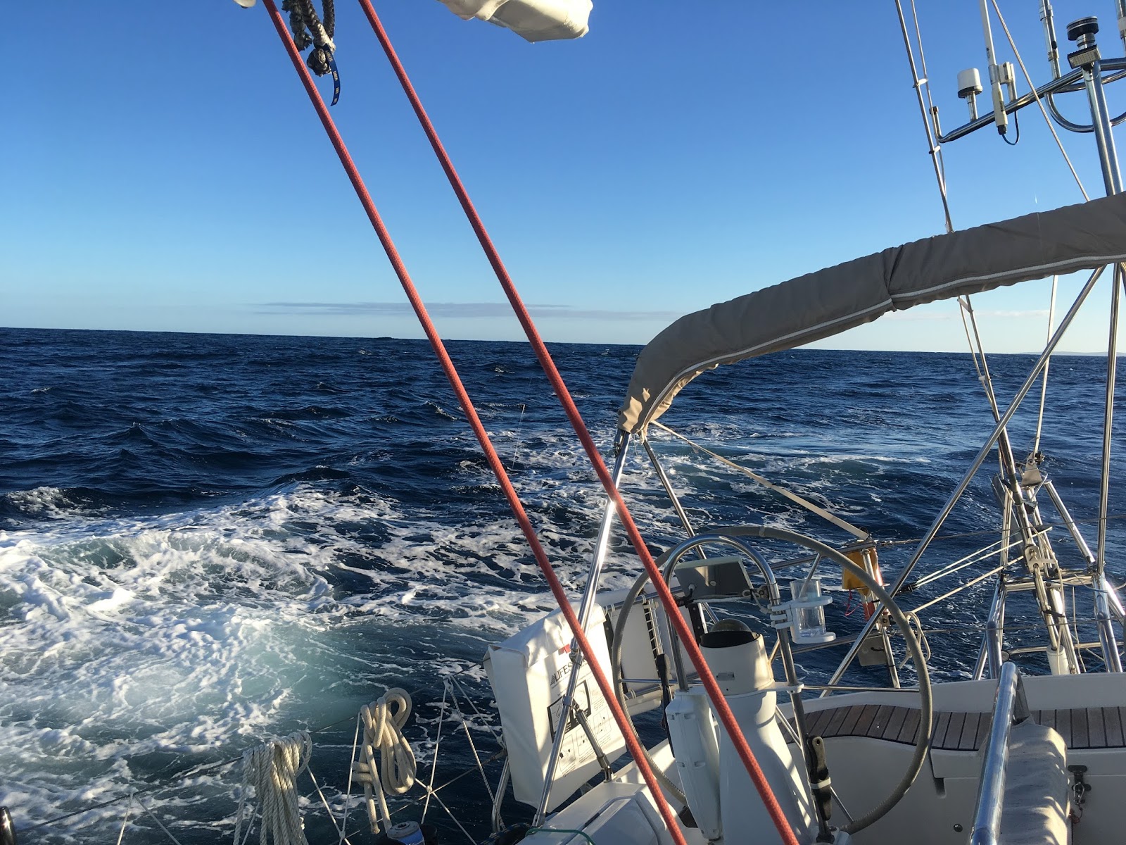
We made 140 nm towards Hobart during our first day at sea. We departed about 24hrs ago right as a weather front swept the coast and brought winds with a more westerly component to help us make our way across the high pressure system that was forming to south of us. We made it to the south of the high pressure and found the westerly's after 24 hours of difficult sailing related to the high winds and confused seas generated by the front. The first half of the day was windy with sustained 30kts of wind at times. The seas were very lumpy and confused, with some breaking crests. As we departed the headlands of the Albany’s natural Harbor and headed in to the open seas, we were escorted by a pod of Dolphins playing in our bow wake.
Eric and Peter mostly hand steered until about 3pm to better manage the confused wave patterns. And of course, they were excited to finally be sailing so enjoyed the sporty seas! Towards the evening, the seas began to organize and lay down. By 3am we started periodically motoring, then sailing when the wind was higher than 8 knots.
Motored total of 4 hours in the last 24 hours. We are very glad we did not leave out in advance of the cold front’s approach, as we would have encountered even more wind and bigger seas. As it was, we got enough of a southeasterly run to make it to the south-side of the high pressure and the westerly winds which was why we headed out in the front in the first place.
We are using PredictWind weather routing over
IridiumGo and for the last 24 hours, we’d say that the ECMWF model was the most
accurate. This is the European Center for Medium Range Weather Forecasts model. As it turned out, we found ECMWF the most
accurate for the whole trip. More about
that in a separate blog.
 |
| Down wind sailing (wind is behind us) |
Position at 8:00am 37 40.0S,
122 34.6E Speed over Ground (SOG) 6 knots, Course over Ground (COG) 135 degrees
Traveled 135 nautical miles in last 24 hrs; 280 miles cumulative.
Traveled 135 nautical miles in last 24 hrs; 280 miles cumulative.
Wind has been light and westerly
during last 24 hours. Motored until 2:30pm yesterday, since then been sailing
in light winds. The wind is averaging 10 knots from the West. Needed to sail a
bit more southerly than ideal to keep wind in sails. Great sleeping conditions
though, so crew has had some well needed shut eye between their 2-hour shifts.
Saw the most amazing glowing
creatures in the sea last night. Sailed through a massive group of dinner plate
sized illuminated creatures that stretched to the horizon and were spaced every
few meters. Normally you only see fluorescence in the water disturbed by the
wake of the boat, so this was really special.
When sailing, been using the Monitor
wind vane for steering and it has been doing really well.Expect winds to decrease and then build over next 24, so hoping to be able to sail rather motor today. We like the fact the weather models have converged, and nothing looks scary for the next week.
 |
| Peter on watch in board shorts and 'foulies'. it is about 12C (55F) |
Day 3 – 16 February
2018, Friday
Current location at 8am AWST is 39 27.3S 124 35.84E. Wind 13kts from 270
degrees.
SOG 6.5 Kts, COG 140 degrees
SOG 6.5 Kts, COG 140 degrees
Sailed 141 miles last 24 hours; 420 nautical miles cumulative
Yesterday was a slow wind day, with less than 10kts, averaging 8 knots
making progress difficult and ride noisy with sails / rigging banging around at
times. Motored about 1 hr total when wind fell below 4 kts. Overall a
frustrating day, these last 24 hours.Wind just now filling in and hope for better progress and ability to sail higher course today. But all is well, everyone is healthy, Katmai has no issues either. Made water so tanks are full. Been sailing mostly using the Monitor vane.
Prediction is for winds to slowly build overnight, which
would be welcome.
Day 4 – 17 February 2018, Saturday
8:00
am position is 41 24S, 127 28E,
COG
113 degrees SOG 6.4ktsWind westerly at 270-290, 10-15 knots, dying
Sailed 180 nautical miles last 24 hours;601 miles cumulative
In
the last 24hrs made about 180 nm, a big day for Katmai. This was aided by about 5 knots more wind
than any of the models predicted for most of the day, and a significant boost
from favorable 0.5 knot current during the afternoon. Able to sail the entire
24 hr period under main and Genoa. Put
first reef in main before dark and glad we did as gusts went in to mid 20’s
first half of night.
Currently
planning on following ECMWF weather route option, at least for now. ECMWF has
been the most accurate of the models. It
also does not have us go as far south as the GFS model, a plus. Over last 24 hours been struggling at times
to keep a reasonable course over the ground due to cross seas and very gusty
winds at times that would head up the boat.
Sea state and gusts seem to want us to go to Antarctica. 🙈
Everyone
is well and in good spirits. Baking scones for breakfast, if only to warm up
the cabin, for a while. Air temp 17 C but damp from frequent fog and
misting. Sea temp 12 C.
In
next 24 hours, expecting winds to ease, and switch to the south, then clock
around to the northeast. Expect to have
to motor through the night tonight.
Will
use that opportunity come up in course from 130ish to 110 degrees or so, a more
direct rhumb line to Hobart. Not
looking forward to several days of upwind sailing. It could be miserable if the sea state does
not cooperate. Sea state seems to fluctuate from lake-like (rarely) to
mountains of swells, and it seems rather unrelated to local winds. Glad
to see there is nothing too scary forecast weather wise, certainly not until late
on the weekend of the 23rd. If we can
keep the ECMWF weather route schedule, we will arrive Hobart early on the
24th.
However,
several days of up wind sailing starting tomorrow is a wild card on how well we
will keep pace. If we are bashing into
waves and swell, we will slow right down to just a few knots.
This
of course is only our current thinking, there are 950 nm and 6 days to go, and
things will change as they always do. We
are doing well on fuel, so expect to be able to motor when winds are less than
about 8 or 10knots. We have motored 12
hours total to date, and have fuel for about 80 more hours.
All
systems are working fine.Really great to have Peter on board, everyone is getting more rest and he is super capable...and like Laurie, he does not get sea sick...🤗 Eric is doing great regarding sea sickness on new meds “Zofran Zydis” which is Ondansetron 8mg.
Let’s
hope up upwind sailing goes easily.
Day 5 – 18 February 2018, Sunday
Position at 8:30 am 42 01E, 130 24.6S
Sailed 135 nm last 24 hours, 736 nautical miles cumulative
Wind 20-25kts from heading 100 degrees. Bummer, the wind is coming from exactly where we want to go. Wind has been 10 kts higher than forecast since 2:30 am
On port tack with double reefed main and reefed Genoa.
Progress slow and low due to counter current of 0.6 knots and bashing in to some of the waves.
SOG ranges from 5-7 knots, probably averaging about 6.COG we have tacked a couple times but with wind coming directly from rhumb line, it is hard going, hard to get a favorable heading.
Hopefully wind will indeed shift to north sooner than later. Wind is forecast to build over next couple days another 10 knots
Currently
on this port tack, probably 153 COG but with waves and wind flux, ranging from
from 160- 140 degrees.
A
cyclone that formed over Tonga a week ago is now in the Tasman sea headed for
New Zealand. This is preventing the
normal progression of high pressure systems across the bight from west to
east. In this case, the high is sliding
south and we find ourselves in the northern portion of the high, which means
easterly winds, winds on the nose.
Day 6 – 19 February,
Monday
8:00am
position is 42 53.3s, 132 45.1e
Sailed
116 nm last 24 hours; 852 nautical miles cumulativeAll well on board, everyone got some sleep finally after a restless couple days.
Wind
17-22 knots from 65 degrees, not as far north as any model predicts, and versus
ECMWF model, which we believe to best represent what we are seeing here, wind
speed higher overall and the lulls wind speed is lower.
Occasional
light puff that is difficult to sail from a more favorable direction, from the
northeast, 40 degrees.
Currently
doing SOG 5.8 kts. SOG average with a 0.7 knot adverse current (was a favorable
current yesterday afternoon) Seas: huge southern ocean swells have laid down
mostly, occasional train of several comes through. Wind waves from north are starting to build,
which of course indicates a more favorable wind is on its way, but until things
settle in we are slamming our bow and slowing down as a result going up to a
knot less than ECMWF based route has forecast and sailing 10 degrees lower to
keep boat moving at all...and wind is more easterly than any model suggests.
Yesterday
with the same wind velocity and better current we were averaging high 7 SOG and
better able to keep (COG) course over ground we desire.
Expect
winds to build and go northerly this afternoon, will help us to lay
course. Currently under double reefed
main and full Genoa.
Yesterday
morning was tough when strong easterlies came in, there were large 4+ meter
ocean swells from the south against the wind. And of course, the wind was
coming exactly from where we wanted to go.
We did 3 tacks back and forth across the wind until we had 30 minutes of
wind from the NE, making the port tack more favorable, which is what we
wanted. Was difficult sailing. The tacking/conditions were hard work for all
and a bit demoralizing as for every mile we sailed, we were probably only
making 1/3 mile good to where we wanted to go (Tasmania). Thoughts of diverting and going northeast to
Portland / Adelaide emerged, ok only briefly.
But
amazingly, exactly as ECMWF PredictWind weather router predicted, precisely at
2:15 pm the wind shifted to north of the lay line.
How
did they do that?
When
we tacked back on port for the long leg to Hobart, we were very relieved to see
we could sail to the ECMWF route numbers, at least sometimes. However, overall they have been too
optimistic on how far north the wind was at any given time, and winds overall
are about 5 knots higher. More wind lulls
than anticipated and they are just a couple knots and useless for sailing.
We
are doing well though and overall happy with progress. Should have wind for next 36 hours as this
front that is behind us approaches us and slips to the south behind us. Should bring the promised north winds. We’ll have a better sense of arrival time
after that, but should be this weekend.
Day 7 – 20 February,
Tuesday
Position at 11:30 am 43 38.2S 136 26.5E
Sailed 160 nm last 24 hours; 1012 cumulative nautical miles since
departing AlbanyWind 20 kts from 55T
COG 101T ...note rhumb line is 91 T, sailing as close to it as possible
SOG has averaged probably 6.5kts
We have just come out of a high wind period, hopefully most of it is
behind us. It was a very dark
gale-ridden night. Highest wind was 37
kts. Spent most of last day sailing with two reefs in the main and with the
stay sail.
Forecast is for wind to slowly diminish to spot in where we will motor
tonight through tomorrow.
By early morning, we were sailing with full main and staysail as wind lightened.
By early morning, we were sailing with full main and staysail as wind lightened.
Yesterday about 3pm winds kicked up to 27kts average, with sustained
gusts in to the low 30’s. Sailed in sloppy seas through the night cracked off
about 10 degrees from desired course to maintain some boat speed/power in the large
and confused waves. Otherwise we just crashed in to them which slowed our
progress each time. Was very uncomfortable on board, as it was really hard to
hold footing and prevent being bashed about (and potentially seriously injured)
by the motion. Difficult/impossible to sleep, hard to wedge in to a bed even
with lee cloths. Sea state eased and became more organized through the night,
but not the high winds. The improved sea
state made the ride a bit better.
At 9am winds decreased suddenly to 19 knots and seemed stable enough to
go to larger head sail( Genoa). Then dropped further to 14 knots so needed to
take the 2 reefs out of the main, so we did. At 11:30 wind shifted back to
25kts so we changed to smaller head sail, the staysail. Wind now seems to have
settled in very high teens. Boat is sailing well.Still have adverse current of 0.8 kts. For example, boat speed is 7.2 knots through the water and our speed over ground per the gps is only 6.4 knots
Wind is forecast to slowly decrease to almost nothing and plan has us motoring tonight through tomorrow.
Laurie has had some sleep, Peter a bit less, and Eric is resting, hopefully sleeping now. Everyone reports feeling well this morning, but very tired.
Been too rough to use stove until this morning, sure enjoyed that cup of
coffee, first in two days. Interestingly enough, one of the most common severe
injuries at sea is from boiling water related to cooking in rough conditions,
so we err on the side of caution and do not use the stove or cook top when
conditions are really rough.
 |
| Windward sailing in about 15kts of wind |
Position at 8 am44 deg 16’S / 139 deg 07’
COG/SOG: 120 deg T / 7 kts
Sailed 133 nm last 24 hours; 1145 cumulative nautical miles since departing Albany
Had a comfortable sail east most of
yesterday. Still seeing northeasterly breeze of about 15 kts. Plan is to sail
this breeze either until it dies and then we motor. We are following the
Predictwind ECMWF routing, sail when we can and motor when needed. They are
taking us south to the high, then motor in the high for a day or so headed due
east. Once the breeze fills in from behind us we will tack northeast. This
strategy takes off 7 hrs from our ETA as compared to staying out of the high
and sailing. Currently all indications are that we will beat the approaching big
low pressure system (storm) to Tasmania with only a bit of time to spare.
Seeing a few snippets of blue sky today, been
wondering if the color blue is anathema to the Southern Ocean. Taking turns getting some well needed rest.
Day 9 – 22 February 2018, Thursday
As of 8 am Lat/lLong: 44 35.15’S / 142 12.976’ECOG/SOG: 85 deg T / 5.7 kts
Sailed 136 nm last 24 hours; 1281 cumulative nautical miles since departing Albany
Wind 3 kts, from 61 degrees True, seas are oily calm
Reached the high yesterday at about 2 p.m., been motoring east since
then. Looks like ECMWF weather model has us continue motoring until 4 to 6 p.m.
today, then turn NE on a filling breeze. We have about one day and 19 hours to
go before making landfall in Tasmania. It’s quite amazing how accurate these
models are, especially the ECMWF model. We are doing well on fuel having used
about half our supply so far this trip, leaving us about 45 hrs of additional
motoring time if required.
We all had showers for the first time since departure and Laurie has
fixed some awesome cinnamon rolls for breakfast. The calm conditions that lead
to motoring do give us hot water as well as ability to cook well and sleep.
 |
| Motoring in a high pressure system at sunrise |
Day 10 – 23
February 2018, Friday
Lat/Long: 43 52.58’S / 144 47.54’ECOG/SOG: 89 degrees T / 5.6 kts
Wind 4 kts. from 100 degrees
Sailed 131 nm last 24 hours; 1412 cumulative nautical miles since departing Albany
At 5:30 pm decided to peel off from motoring in the high earlier than models suggested yesterday. We were getting concerned that waiting until 8-9 p.m. before turning NE would eliminate our options regarding uncertain wind directions near Tasmania.
This was an exciting direction change as we were now headed more or less directly to Tasmania. We started sailing in 9 knots that built through the night to gusts near 20 knots. At sunset, it was a lovely lifting fog and clouds.
The sail NE through the night was a rambunctious beat and as always windier than predictions.
By morning, we were motoring in the small high just south of TAS waiting for the wind to fill in from behind. Every model has a different view of when that might occur as a low pressure storm approaches.
Around mid day we captured our first glimpse of land, the mountains of the south west cape of Tasmania. The navigator (primarily Laurie) was especially happy to see land where and when anticipated after 10 days at sea. What joy ! Land ho shouts all around! A few happy dances too. It was just a glimpse though, as fog and misty rain shrouded our destination.
We should reach our major passage waypoint south of Mewstone Rock by 8 p.m. this evening. From there it is another 30 miles NE to the mouth of the D’Entrecasteaux Channel. We should reach the channel’s mouth by about 1 a.m., Saturday. We will slow the final approach to the channel so as to enter it at first light Saturday.
Our next update will hopefully be from within the D’entrecasteaux Channel on the southeast corner of Tasmania.
 |
| Eric and Peter drinking coffee on way to anchorage in Alexander's Bay, Bruny Island, Tasmania |
Yippee! We made it safely to Tasmania
At 9 am local time, we were at 43 14.37E, 147 16.6S and motoring at 5.8 knots
Sailed 131 nm last 24 hours; 1570 cumulative nautical miles since departing Albany.
We made landfall at midnight last night, then slowly proceeded up the D’Entrecasteaux Channel. By the skin of our teeth we got in to protected waters before a significant Low pressure system overtook us. We had up to 35 knots from the northwest while we were reaching along the southern coast of Tasmania during the evening and that was only the pre-cursor to full storm. The wind eased as we entered the wind shadow that Tasmania provided. However, the wind was shifting to due west and forecast to build to sustained 40 knots, gusting to 60. We made it in to the D’Entrecasteaux Channel just in time to avoid these high winds.
Our first destination this morning was Kettering where the marina said they would have space for us on their collector’s jetty. However, due to the bad weather, there was no room so we elected to go to Alexander’s Bay, a protected cove and anchor. This bay is on Bruny Island, just east of Kettering. We dropped anchor in 30 feet of water at 10 am as the front approached and wind began to gust in to the 30kts range in our anchorage. Finally stopped after 11 days at sea, almost to the exact hour!
Day 12 – February 25th, Sunday HOBART TASMANIA
Final Position 42 54S, 147 20E, Derwent Sailing Squadron Marina, Hobart, Tasmania
Motored 27 nm last 24 hours; 1570 cumulative nautical miles since departing Albany.
After breakfast, we pulled anchor and motored the 27 miles to Hobart and the Derwent Sailing Squadron (DSS) Marina where we had secured a “pen” berth for Katmai. The DSS marina is a wonderful new floating marina. Katmai is secure and we are catching up on rest and so very excited to be in lovely Tasmania!